
What we do
At Red River Geospatial, we specialize in cutting-edge GIS mapping, 3D modeling, and drone imagery. Our goal is to help clients better understand, plan, and manage their landscapes through precise spatial data and high-resolution aerial analysis. Whether it’s mapping terrain, monitoring environmental changes, or creating detailed 3D site models, we deliver actionable insights that turn complex land data into clear, visual results.
meet the owner/operator
Chris Miller
Chris has worked in the GIS (Geographic Information Systems) field since 2020 and flying drones since 2022. His experience has been in wetland delineation, sewer system, storm water, drinking water system mapping, government grant maps, road infrastructure data updates, and more. On top of his GIS experience, Chris is an FAA part 107 UAV pilot specializing in 2D Orth mosaics and 3D models through photogrammetry. Give him a call, text, or email to further discuss project needs.

Projects
-
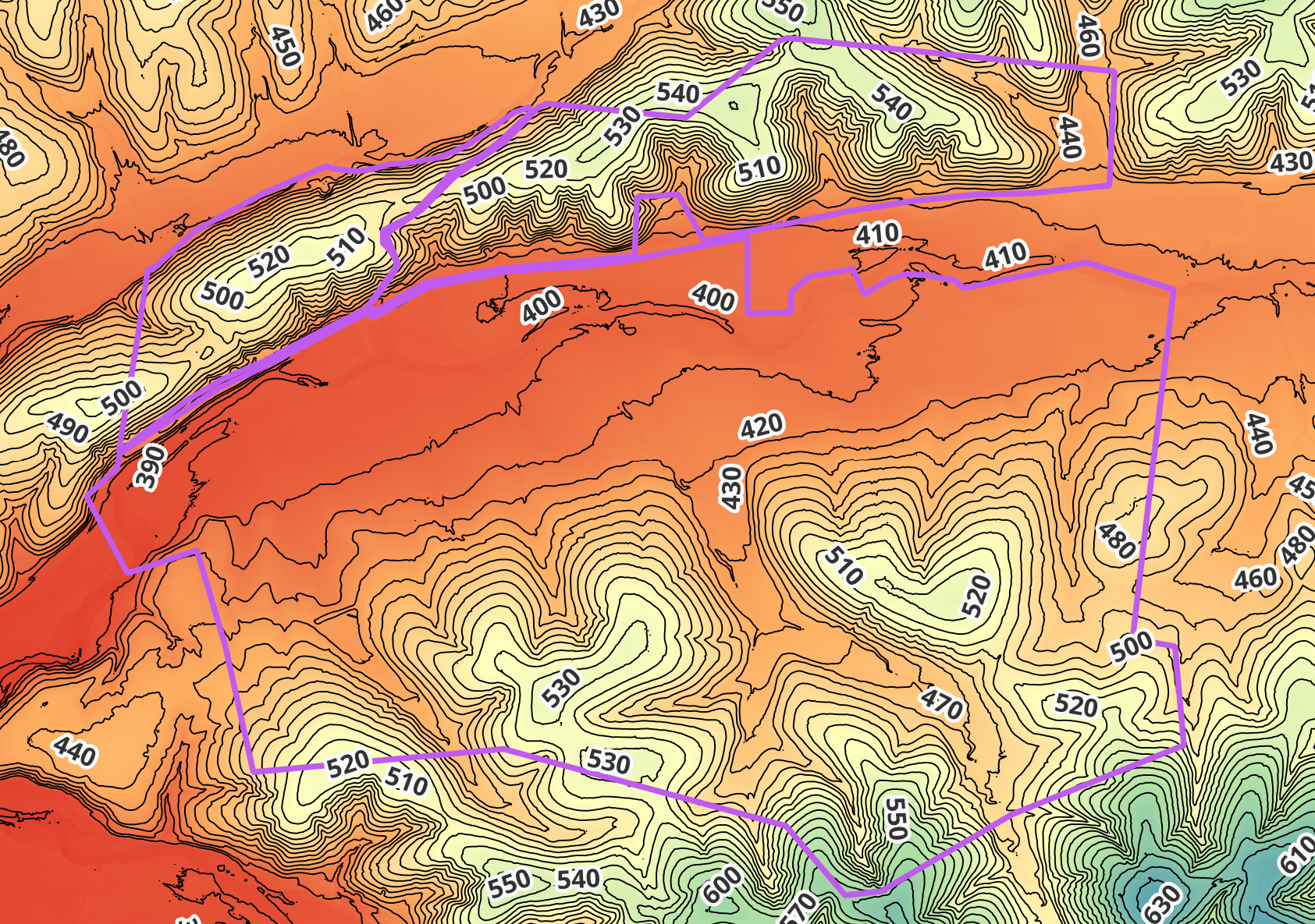
![Digital Elevation Models (DEM)]()
Digital Elevation Models (DEM)
A Digital Elevation Model (DEM) is a 3D representation of the Earth's surface that shows elevation data for every point in an area. In mapping, DEMs are used to visualize and analyze terrain features such as slopes, valleys, and watersheds, helping with applications like flood modeling, construction planning, and environmental management. They provide accurate, detailed elevation information that enhances spatial analysis and supports better decision-making in geospatial projects.
-
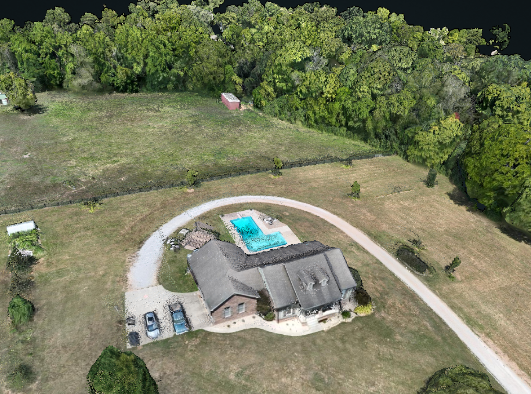
![]()
Digital Surface Model
A Digital Surface Model (DSM) represents the Earth’s surface, including all natural and man-made features such as trees, buildings, and other structures. In mapping, DSMs are used to analyze surface characteristics, model urban environments, assess line-of-sight and visibility, and support 3D visualization. They are especially valuable in applications like city planning, forestry, and drone mapping, where understanding the true surface elevation—including objects above ground—is essential.
-
![]()
Drone 2D Orthomosaics
A 2D orthomosaic is a high-resolution, georeferenced aerial image created by stitching together multiple overlapping photos taken from a drone or aircraft. Each image is corrected for perspective, camera tilt, and terrain distortion (orthorectified), so the final map has a uniform scale and accurate geographic alignment. Essentially, a 2D orthomosaic is a true-to-scale overhead map that can be used to measure distances, areas, and features just like a traditional map.
-
![]()
Drone 3D Modeling
Drone 3D modeling is used to create accurate, detailed representations of terrain, structures, and environments for various applications. It helps in natural disaster damage assessments, construction monitoring, urban planning, environmental assessment, and infrastructure management. By providing realistic, measurable 3D data, it allows professionals to analyze, plan, and visualize projects more efficiently and cost-effectively.


Let’s fly!
Whether you are working on restoring your land, farming with technology, needing construction site progress data, or conducting environmental studies, we are here to help. Contact us to see how we can assist in your project needs.